

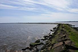
Cape Fear
Cape Fear is the name of a cape (pictured above) and a river that flows into the Atlantic just southwest of the cape. As a young boy I lived about fifteen miles north of this point in the resort town of Carolina Beach.

As this map shows, the eastern coast of the United States swings sharply to the northeast until it reaches the outer banks of North Carolina. North of Hatteras, the coast trends in a more northerly direction until turning northeast again in New England. The North Carolina capes, Cape Fear, Cape Lookout and Cape Hatteras, jut far into the Atlantic and suffer the consequences of such exposure in the form of frequent storms.
These fierce storms sometimes break through barrier islands and form new inlets connecting the ocean to inland waters. One such storm occurred in 1761, and ocean waters broke over the lower Cape Fear peninsula and created a new inlet into the Cape Fear River.

The Lower Cape Fear River
During the Civil War, the existence of the new inlet was a great boon to Confederate blockade runners. The main channel remained open and was guarded by Union ships, but the new inlet, under protection of the guns of Fort Fisher, also had to be watched; and shallow drafted ships often evaded patrols and made it through the inlet and up the river. Because of this situation, Wilmington remained as the last major Confederate port. That ended with the capture of Fort Fisher in January 1865.
Despite its usefulness to the Confederacy, after the war the new inlet became a growing problem for the port of Wilmington. Ocean tides and storms rushing through the new inlet created shifting sand bars at the river’s mouth and hampered maritime traffic.
Between 1870 and 1891 the United States Army Corps of Engineers erected a rock dam to close the new inlet and protect the main river channel from further silting. “The rocks,” as the entire dam was called, measures from 90 to 120 feet wide at the base, and the average depth of the structure is 30 feet from top to base. Water levels are approximately equal on either side, and at high tide only a small part of the dam rises above the surface. The rocks eventually extended from Federal Point to Zeke’s Island and on to Bald Head, more than three miles total.

Map of the Rocks North of Baldhead
The rocks did their job, and over time the dam was buttressed by accumulating sand bars and dunes. The dam withstood more than a score of major storms in the following 130 years with no signs of a break, and today the rock dam still holds firm.
The Rocks
Most importantly, the dam accomplished its intended purpose. It permitted deepening of the main Cape Fear River channel. Therefore, because of the rocks, the modern port of Wilmington can accommodate the very largest container ships.
Hats off to the Corps of Engineers

The Port of Wilmington
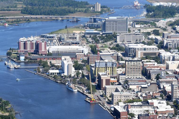
Downtown Wilmington Riverfront
